Brushkana Creek cabin a remnant of Denali transportation history
 |
| Brushkana Creek cabin in 2013 |
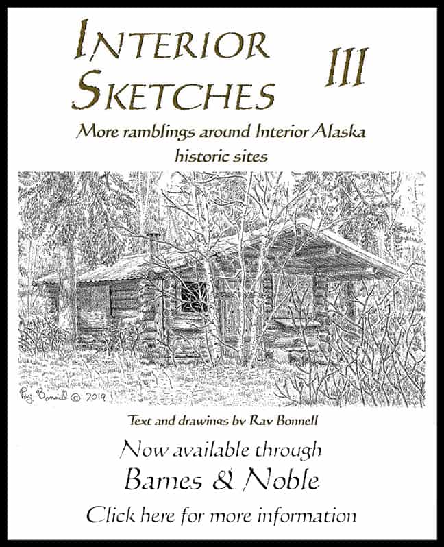
The Alaska Road Commission (ARC) cabin on Brushkana Creek (shown in drawing) is one of the few remnants of the Cantwell-Valdez Creek Trail.
Bruskana is a clearwater stream that cascades northward out of the Talkeetna Mountains, crossing the Denali Highway and eventually joining the Nenana River. It is a popular recreation destination. Grayling are plentiful, and the creek is floatable from the Bureau of Land Management Brushkana Creek Campground located at the Denali Highway crossing.
During the early 1900s the area was only accessible on foot or horseback. The Alaska Range between Cantwell and the Susitna River was little explored by Westerners, although it had been occupied by Ahtna Athabascans for generations.
A 1903 gold discovery at Valdez Creek near the Susitna River’s headwaters (about 55 miles east of Cantwell) caused a minor stampede, but the first trails to the gold regions were from the east, taking off from the Valdez-Fairbanks Trail.
With the completion of the Alaska Railroad as far as Cantwell in 1919, the distance for freighting supplies to Valdez Creek shrank dramatically — 55 miles instead of the 250 miles from Valdez, or 200 miles from the Copper River and Northwestern Railroad at Chitina.
Freighting naturally shifted to the shorter western route. BLM documents state that the Alaska Railroad quickly blazed a year-round trail (pack-horse trains in summer, horse and dog-drawn sleds in winter) to the mines. It ran east from Cantwell along the Nenana River and Brushkana Creek until climbing out of the Nenana River drainage onto the Susitna River flats and then crossing the Susitna to Valdez Creek. In the summer, freight had to be ferried across the river.
The trip from Cantwell to Valdez Creek took three days, and the ARC, which assumed maintenance of the trail in the 1920s, built three shelter cabins, located 20 miles, 30 miles, and 43 miles from Cantwell. Each cabin was built of logs and had the same dimensions (about 14 by 16 feet). A slightly larger log barn to shelter dogs and horses was erected next to each cabin. The 30-mile, or Brushkana Creek Cabin, is the only remaining ARC shelter cabin along the route.
Freighting over the trail was expensive, and the Valdez Creek miners kept pushing for construction of a road. The ARC began upgrading the trail in the 1930s and constructed a wood-truss bridge across Brushkana Creek, about a mile upstream from the 30-mile cabin.
However, by the time the bridge was completed, the ARC had decided to shift the road route to higher ground south of the Nenana River, bypassing the lower section of Brushkana Creek. The Brushkana Creek Bridge was never used…except as building material. Sometime after the bridge was abandoned, an addition to the Brushkana Creek cabin was built with decking salvaged from the bridge. The bridge abutments are still there.
According to a 1936 U.S. Geological Survey report, 30 miles of road were completed by the mid 1930s. The road link to Valdez Creek would not be completed, though, until the Denali Highway was constructed in the 1950s.
The Brushkana Creek cabin (with a metal roof) is still in fairly good condition, although the sod-roofed addition is starting to cave in. BLM has boarded up the structure due to vandalism and unauthorized alterations. The barn is long gone.
Sitting on public land, the cabin can be easily reached via the three-mile-long Brushkana Creek Trail which starts at the Brushkana Campgound. It’s a lovely trail, but when we hiked it in July we saw plenty of moose and bear sign. So if you go, take along bear protection.
Sources:
- An Historical Resource Study of the Valdez Creek Mining District, Alaska. Peter F. Dessauer & David W. Harvey. U. S. Bureau of Land Management. 1977
- “Appendix I: Wild and Scenic Rivers,” in “East Alaska Proposed Resource Management Plan.” BLM. 2006
- Correspondence with John Jangala. BLM archeologist
- The Broad Pass Region, Alaska; with sections on Quartenary Deposits, Ingneous Rocks and Glaciation – Bulletin 608. Fred Howard Moffit & Joseph R. Pogue. U. S. Geological Survey. 1915
- “The Valdez Creek Mining District, Alaska in 1936 – Bulletin 897-B,” in Mineral Resources of Alaska. Ralph Tuck. U. S. Geological Survey. 1936


Nice tidbit of history there. I hike from time to time in the region, and will try and drop by it (with bear protection, of course! 🙂
Now I know where I'm going next 🙂